
ISRO Successfully Launches NVS-03 Satellite: How It Will Strengthen India’s NavIC Navigation System
Byline: Sagufta Rani
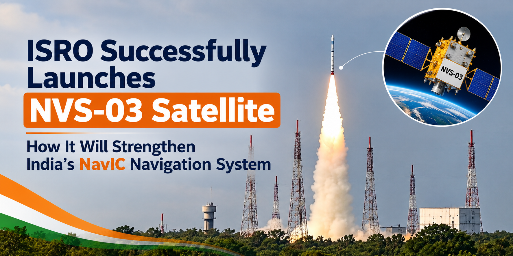
India has achieved another significant milestone in space technology. The Indian Space Research Organisation (ISRO) successfully launched the NVS-03 navigation satellite aboard the GSLV-F18 rocket on October 30, 2026. The satellite was placed into its intended transfer orbit, marking an important step towards strengthening India’s indigenous satellite navigation system, NavIC.
NavIC, which stands for Navigation with Indian Constellation, is India’s regional satellite navigation system. It provides positioning, navigation and timing services across India and surrounding regions.
The NVS-03 mission is important because it introduces advanced navigation capabilities, including an indigenous atomic clock and support for the L1 navigation signal. These technologies are expected to help improve the availability of navigation services and expand the potential applications of NavIC.
In this article, we will explore the NVS-03 satellite launch, its major features, how it will strengthen India’s NavIC navigation system, and what this achievement means for the future of Indian space technology.
What Is the NVS-03 Satellite?
NVS-03 is a next-generation navigation satellite developed by ISRO as part of India’s Navigation with Indian Constellation programme. It is the third satellite in the second-generation NVS series, designed to maintain continuity and improve the capabilities of India’s regional navigation system.
The satellite was launched from the Satish Dhawan Space Centre in Sriharikota, Andhra Pradesh, using the Geosynchronous Satellite Launch Vehicle, GSLV-F18.
The mission was the 20th flight of India’s GSLV rocket. Its primary objective was to place NVS-03 into a Geosynchronous Transfer Orbit so that the satellite could proceed towards its planned operational orbit. NVS-03 is designed to provide navigation coverage over the Indian landmass and a region extending approximately 1,500 kilometres beyond India’s geographical boundaries.
Unlike Earth-observation satellites, which collect images and scientific data, navigation satellites transmit signals that compatible receivers use to calculate their location and obtain accurate timing information. The NVS-03 mission represents an important step towards maintaining India’s independent navigation infrastructure and reducing reliance on foreign satellite navigation systems for essential domestic applications.
Key Highlights of the ISRO NVS-03 Satellite Launch
Here are the main details of the mission:
- Satellite name: NVS-03
- Space agency: Indian Space Research Organisation (ISRO)
- Launch vehicle: GSLV-F18
- Launch date: October 30, 2026
- Launch location: Satish Dhawan Space Centre, Sriharikota
- Mission objective: Strengthen India’s NavIC navigation system
- Major technology: Indigenous atomic clock
- Navigation signals: L1, L5 and S bands
- Coverage: India and approximately 1,500 kilometres beyond its geographical boundaries
- Orbit after launch: Geosynchronous Transfer Orbit
The satellite’s successful placement in its intended transfer orbit is an important milestone. However, additional orbital manoeuvres, system checks and commissioning are required before its operational contribution can be fully assessed.
What Is NavIC, and Why Is It Important for India?
NavIC stands for Navigation with Indian Constellation. It was previously known as the Indian Regional Navigation Satellite System (IRNSS). NavIC is an independent satellite navigation system developed to provide reliable positioning, navigation and timing services for India and surrounding regions.
The system has two main service categories:
1. Standard Positioning Service
This service is intended for civilian and commercial applications. It can support navigation, transportation, tracking and other location-based services.
2. Restricted Service
This is an authorised service intended for specified users and applications requiring restricted access.
Satellite navigation works by transmitting signals from satellites to receivers on the ground. A compatible receiver uses signals from multiple satellites to estimate its position. For example, when someone uses a navigation application to find a route between home and the office, the device uses satellite signals and other available positioning technologies to estimate its location.
India’s NavIC system is important because it provides a domestically controlled regional navigation capability. Such infrastructure can support transportation, telecommunications, disaster management, infrastructure development and other critical activities.
What Is NavIC, and Why Is It Important for India?
The NVS-03 satellite is expected to strengthen NavIC in several important ways.
1. Improving Navigation Service Availability
A satellite navigation system needs a sufficient number of operational satellites to provide reliable services.
When older satellites stop functioning or new satellites encounter technical problems, the availability of navigation services may be affected. The NVS-03 mission adds another satellite to India’s next-generation navigation programme. This is particularly important because the availability of operational satellites has been a challenge for NavIC.
By expanding the constellation, NVS-03 can contribute to improving service continuity once it completes commissioning and becomes operational. However, a successful launch alone does not guarantee that all navigation services will immediately become available. The satellite must complete its planned orbital and technical checks.
2. Introducing the L1 Navigation Signal
One of the most important features of NVS-03 is its support for the L1 navigation frequency, alongside the existing L5 and S-band signals. The L1 frequency is widely used by satellite navigation systems and is supported by many modern navigation receivers.
Its inclusion is expected to improve NavIC’s compatibility with devices and applications that use the L1 signal. This could expand the potential use of India’s navigation system in consumer electronics, vehicle tracking and commercial navigation.
For example, a compatible smartphone may be able to use signals from NavIC alongside signals from other satellite navigation systems. This depends on the device’s chipset, antenna, software and supported frequencies. It is important to understand that not every smartphone will automatically support NavIC simply because NVS-03 has been launched.
3. Strengthening Indigenous Atomic Clock Technology
Accurate timing is essential for satellite navigation.
Navigation receivers calculate their position by measuring the time taken for signals to travel from satellites to the receiver. Even small timing errors can affect positioning calculations.
NVS-03 carries an indigenous atomic clock alongside procured atomic clocks. This represents an important step in India’s efforts to develop domestic precision-timing technology. An indigenous atomic clock can help strengthen India’s technological capabilities and reduce dependence on externally sourced components.
Precise timing is also important for telecommunications, network synchronisation and other infrastructure that relies on accurate time references. The development of indigenous navigation technology is therefore valuable not only for space missions but also for India’s wider technological progress.
4. Supporting Transportation and Vehicle Tracking
Transportation is one of the major application areas of satellite navigation.
NavIC can support vehicle tracking, fleet management, transport monitoring and navigation through compatible equipment.
For example, a logistics company transporting goods between Delhi and Mumbai needs accurate location information to monitor its vehicles and manage delivery schedules. Satellite navigation can help such companies track vehicle locations, coordinate deliveries and improve route management.
Similarly, compatible navigation equipment can support applications involving railways, shipping and other transportation infrastructure.
As India’s navigation infrastructure develops, these applications could become increasingly useful.
5. Helping Disaster Management and Emergency Response
Satellite navigation can play an important supporting role during natural disasters and other emergencies.
During floods, cyclones, earthquakes and similar events, emergency teams need accurate location information to coordinate rescue operations and transport essential supplies. For example, during a flood, rescue teams may need to locate affected areas, track relief vehicles and coordinate the delivery of food, water and medical supplies.
Navigation technology can support these activities by helping compatible equipment determine location.
NavIC is not a disaster-warning system by itself. However, it can contribute to emergency-response infrastructure when used alongside weather monitoring, communication networks and disaster-management systems.
6. Strengthening India’s Strategic Independence
Satellite navigation is important for civilian, commercial and strategic applications.
Dependence on foreign navigation systems can create challenges when reliable access to positioning and timing services is essential. India’s NavIC programme provides an independent regional navigation capability that can support domestic requirements.
By strengthening the satellite constellation and developing indigenous technologies, India can improve its control over an important part of its space infrastructure.
NVS-03 is therefore significant not only as a satellite launch but also as part of India’s broader effort to build reliable, domestically developed space technology.
Who Can Benefit from the NVS-03 Satellite?
The benefits of NVS-03 may extend across several sectors as the satellite becomes operational.
Smartphone Users
Compatible smartphones and navigation devices could benefit from expanded support for NavIC signals. However, the actual improvement will depend on hardware compatibility and service availability.
Transport and Logistics Companies
Fleet operators may use compatible navigation systems to monitor vehicles, manage routes and coordinate deliveries.
Maritime and Coastal Activities
Navigation technology can help compatible maritime equipment determine location and support route planning for vessels operating within covered regions.
Surveying and Infrastructure Development
Surveyors and infrastructure professionals can use satellite navigation receivers for location-based measurements and specialised surveying applications.
Telecommunications and Network Services
Accurate timing can support network synchronisation and other systems that require precise time references.
Emergency and Disaster-Management Teams
Navigation signals can help emergency responders coordinate field operations, track relief vehicles and support the transportation of essential supplies.
These are potential application areas of satellite navigation technology. They do not mean that every device or service will immediately receive new capabilities after the launch.
What Happens After the Successful NVS-03 Launch?
A successful launch is a major achievement, but it is only one stage of a satellite mission.
After a satellite reaches its intended transfer orbit, engineers must complete several additional steps before it can provide operational services.
Step 1: Early-orbit operations
Engineers check the spacecraft’s condition and verify that its essential systems are functioning correctly.
Step 2: Orbit-raising manoeuvres
The satellite must move from its transfer orbit towards its planned operational orbit through the required orbital manoeuvres.
Step 3: Satellite system checks
Engineers test the satellite’s communication systems, navigation payload and other important equipment.
Step 4: Commissioning
The satellite’s systems and navigation signals are evaluated to confirm that they meet the required operational standards.
Step 5: Integration into NavIC
After the necessary checks are completed, the satellite can contribute to the wider navigation constellation according to its operational readiness.
ISRO has confirmed that GSLV-F18 successfully placed NVS-03 into its intended transfer orbit. Its subsequent orbital operations and commissioning are important for determining when it can provide operational navigation services.
Official source: ISRO Official Website
The successful launch of NVS-03 is an important milestone for India’s space and navigation programmes. By adding another satellite to the NavIC programme, introducing L1 signal support and carrying indigenous atomic clock technology, the mission creates opportunities to strengthen India’s regional navigation capabilities.
Its potential applications include transportation, vehicle tracking, surveying, telecommunications, disaster management and other location-based services. However, the long-term benefits will depend on the satellite completing its orbital operations and commissioning, the reliability of the wider NavIC constellation and the adoption of compatible devices.
As ISRO continues developing India’s navigation infrastructure, NVS-03 represents another step towards a more capable and technologically independent satellite navigation system.
India’s progress in space technology is not only about launching satellites. It is also about developing reliable systems that can support everyday life, critical infrastructure and future innovation.