
IMD alert: Odisha and Maharashtra are likely to witness heavy rainfall in 5 next days
Edited By: Divya Thearia

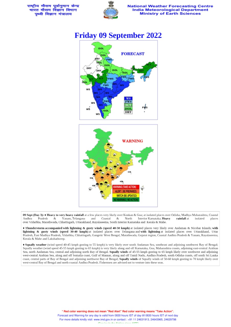
8 September 2022 (New Delhi): India Meteorological Department (IMD) on Wednesday alert that a low -pressure area is likely to form over the West Central area of Bay of Bengal. This sight is likely to result in heavy winds and heavy rainfall in the next 24 hours.

A cyclone circulation lies over East Central
The weather department has also said that extreme rainfall spell is likely to continue over South Peninsular India during next 4 days. The spell is likely to decrease thereafter. Further Odisha and Maharashtra are set to witness very heavy rainfall int he next 5 days. Meteorological centre, Amaravati said that a cyclonic circulation lies over East central and adjoining Southeast Bay of Bengal and extends up to 5.8 km above mean sea level. Under its influence.
Isolated wall of water falls along with Thunderstorm
IMD further also informed about the reducing presence of another cyclonic circulation and trough that were present in Chhattisgarh region and over South Interior Karnataka and neighbourhoods across Andhra Pradesh. Isolated wall of water falls along with thunderstorm, lightning predicted over Arunachal Pradesh on 7 and 8 September, over Assam, Meghalaya, Nagaland, Manipur, Mizoram, and Tripura on 10 and11 September Similar conditions are expected in Coastal Andhra Pradesh, Yanam, and Telangana during 8-10 September the IMD has also given a fisherman warning for the Maharashtra coast, in which they have advised them not to venture into deep waters during the next five days. Other districts which also have been given yellow alerts by the IMD include Palghar, Thane, Sindhudurg, Nasik, Ahmednagar, Pune, Kolhapur, Satara, Jalna, Nanded and Latur.